UGCS
Ground Control
Software

UGCS is a must-have toolset for safe and efficient UAV land
surveying and Industrial inspections
Why use UGCS:
Save time and money
Increase productivity
Higher level of safety
IMPORT
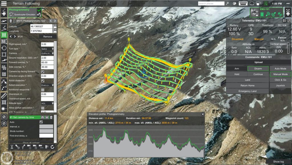
DEM data for missions with terrain following.
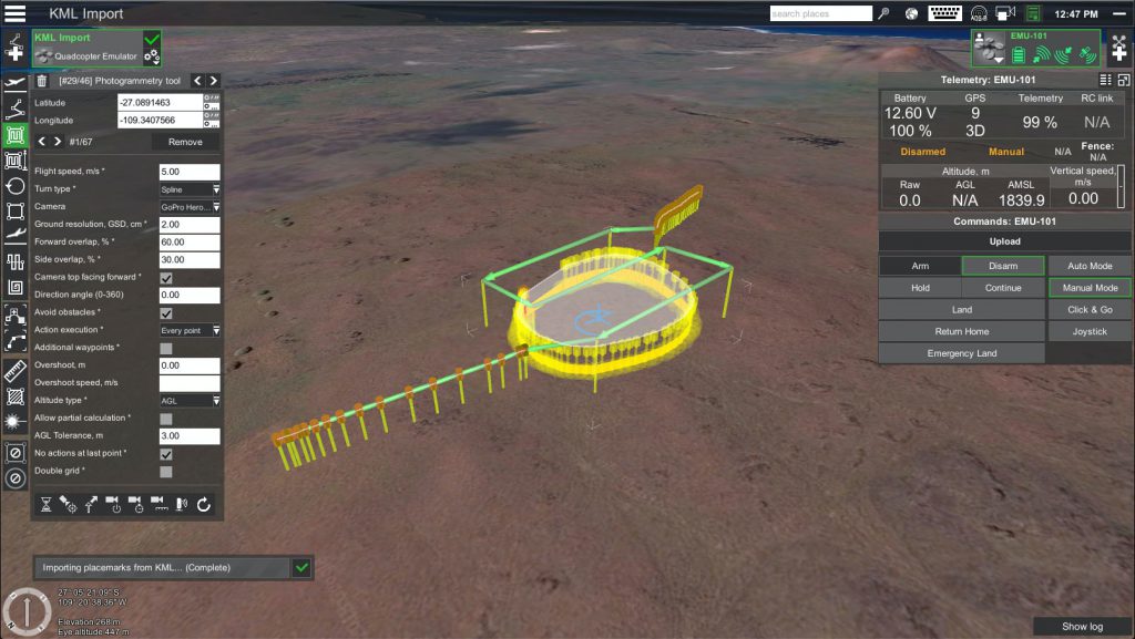
Create place-marks or routes from KML/CSV.
GeoTIFF as map overlays for precise and safe flight planning.


PLAN
Immersive 3D mission planning environment.
Waypoints, Linear, Circle, Perimeter, Area Scan tool.
Photogrammetry mission.
Software emulator.
Create custom No-Fly zones.
FLY
Elevation profile displays UAV’s altitude at every point.
Telemetry display.
Battery change during long routes.
Video recording.
Video streaming from UgCS for DJI to UgCS desktop.
ADS-B receiver & ADS-B Transponder support.
Multi-drone support.


PROCESS
Telemetry player.
Geotagging tool.
UgCS Mapper to create offline 2D maps.
For more information go to www.ugcs.com and use code FUREUGCS for discounted price.
Interested in PRO or Enterprise option? Please contact us directly.
QUESTIONS
CONTACT US NOW on email [email protected] or call 0333 990 9847
SERVICES WE OFFER
SOLAR SERVICES
CLOSE INSPECTION & SURVEY
MAPPING AND GIS
INSPECTION PORTAL
3D MODELLING
GROUND CONTROL SOFTWARE
CONSULTANCY AND TRAINING
DETAILED THERMAL INSPECTION
“The service and data delivered to us by Futurewise Aerial was top class. The findings saved us loads of time and lost efficiency, thanks.”
Ryan McShea – Empower Energy Ltd
