3D Modelling
Bring your data to life with 3D modelling
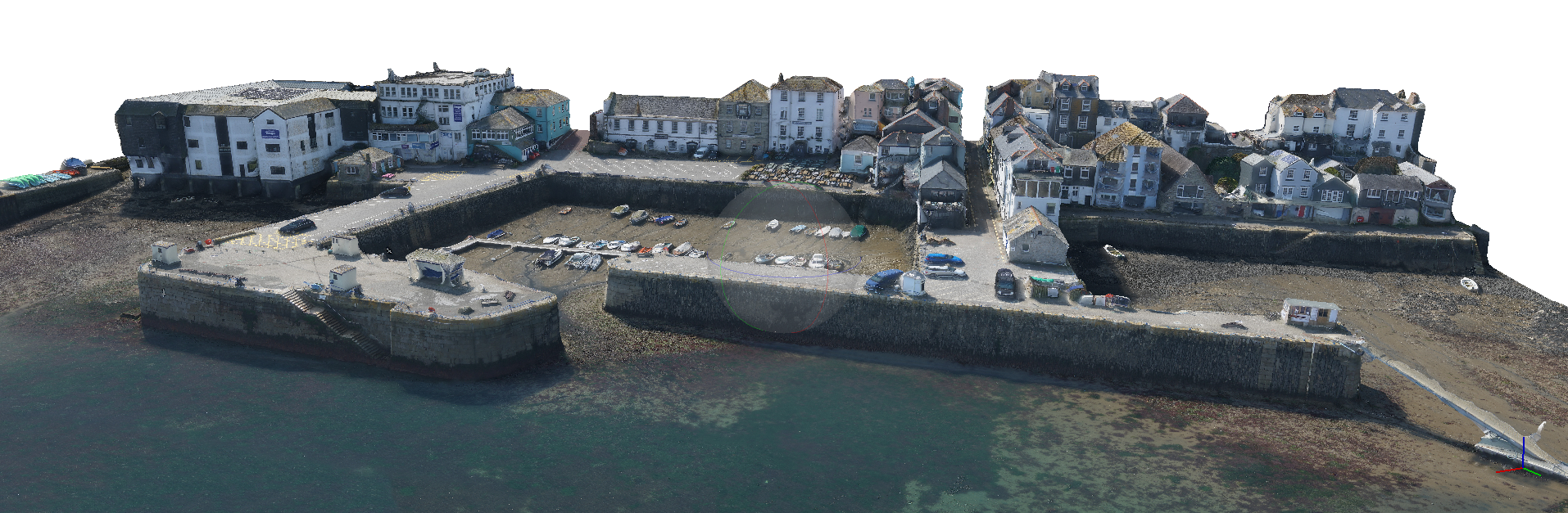
Particularly useful for construction, planning applications and certain asset inspections, 3D modelling allows you bring your data to life and interact with it for all kinds of uses. A series of photographs are taken at regular intervals and spacing. These are analysed using powerful software to create a point cloud (where various elements of the photographs intersect) which is then rendered with a texture and colour matched ‘skin’.
Some of the unique advantages of 3D Modelling:
CLICK HERE to book your free online consultation and demonstration, during which we will explain in detail how 3D modelling will add significant value to your project.
CONTACT US NOW on email info@futurewise-aerial.com or call 0333 990 9847
DETAILED THERMAL INSPECTION
“The service and data delivered to us by Futurewise Aerial was top class. The findings saved us loads of time and lost efficiency, thanks.”
Ryan McShea – Empower Energy Ltd
CONTACT
Address:
138A Southcote Road
Bournemouth
Dorset BH1 3SW
UK
Email: info@futurewise-aerial.com
Phone: 0333 990 9473
Select Futurewise Aerial for your aerial inspection and surveying needs. Professional equipment, software and knowledge leads to accurate and meaningful results.
© Futurewise Aerial 2020 | Website design by Burland Creative.